Rifugio Lavarella is a must-see destination in the heart of the Dolomites, in South Tyrol. The hiking we recommend is one of the most popular summer trekking in this area. Scroll down to see the details of the map.
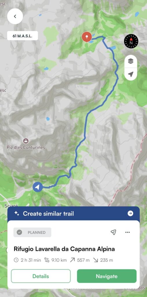
Trail details
| 📍 Departure | Capanna Alpina (1.720 m) |
| ⛰️ Arrival | Rifugio Lavarella (2.050 m) |
| ⏱️ Est time | 5 hours |
| 📏 Length | 18,2 km |
| 〽️ Elevation gain | 557 m |
| 👣 Difficulty | Medium |
How to Get to Rifugio Lavarella: Trail Info
We park our car near Capanna Alpina, a mountain hut located just above San Cassiano, in the heart of Val Badia. Even from here, the view is stunning. We take trail number 11, which is clearly marked, and begin our ascent toward the Fanes Plateau. The first section is the steepest, but the path is well maintained. We make our way up through a series of natural rock steps.
Soon we reach Col de Locia, a mountain pass at 2,070 meters. It’s the perfect place to take a break: the panorama of the Dolomite peaks is absolutely breathtaking. From the saddle, we begin a gentle descent along a well-defined path that leads us into the heart of the Fanes-Senes-Braies Nature Park.
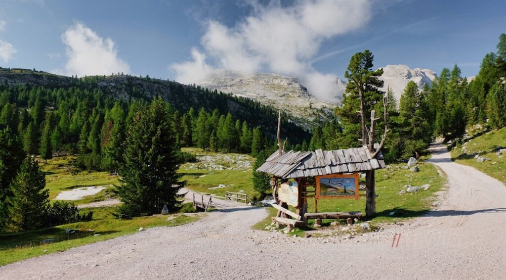
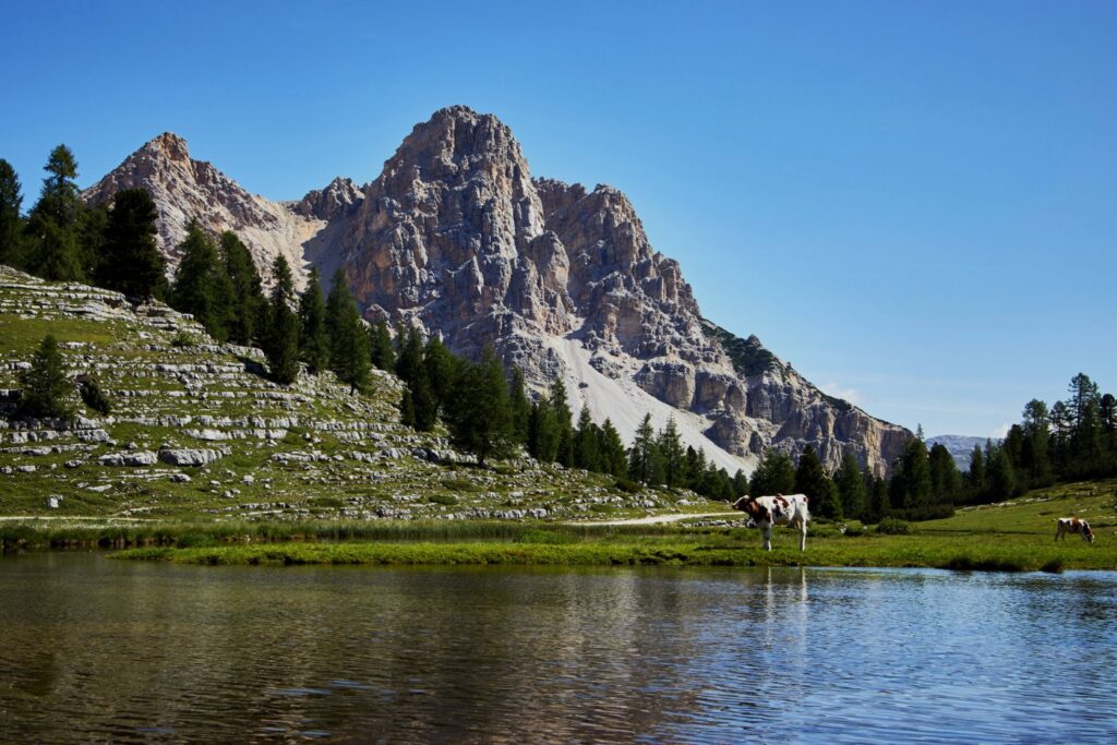
In less than an hour, we arrive at Rifugio Gran Fanes, a small and simple hut—ideal for a short rest. We continue our hike along a wide and mostly flat gravel road, a truly pleasant section of the walk. Soon we begin to see the Limo lake, a sparkling glacial lake surrounded by green meadows.
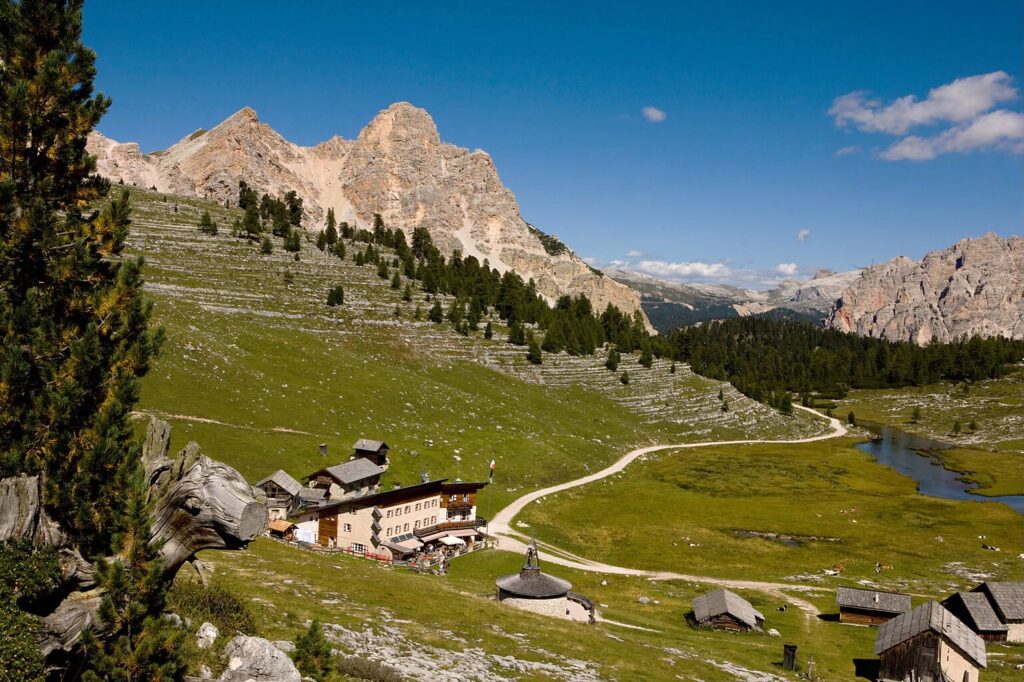
Just a few minutes beyond the lake, we finally reach our destination: the mountain hut Rifugio Lavarella, sitting at 2,050 meters above sea level. A hearty traditional Ladin meal is more than well deserved here and meanwhile, we enjoy the incredible view over the Dolomites.
Remember to plan your hike carefully. Always check the weather forecast before setting out, and respect both nature and the people around you.
Special thanks to hiwio.it, rifugiolavarella.it, südtirol.it, altoadige.com for the photos