If you’re looking for ideas for scenic hikes, the loop trail around Sass de Putia is one you shouldn’t miss. This route combines more challenging sections with easier stretches through meadows and forests, starting from Passo delle Erbe — one of the most enchanting areas of Trentino-South Tyrol.
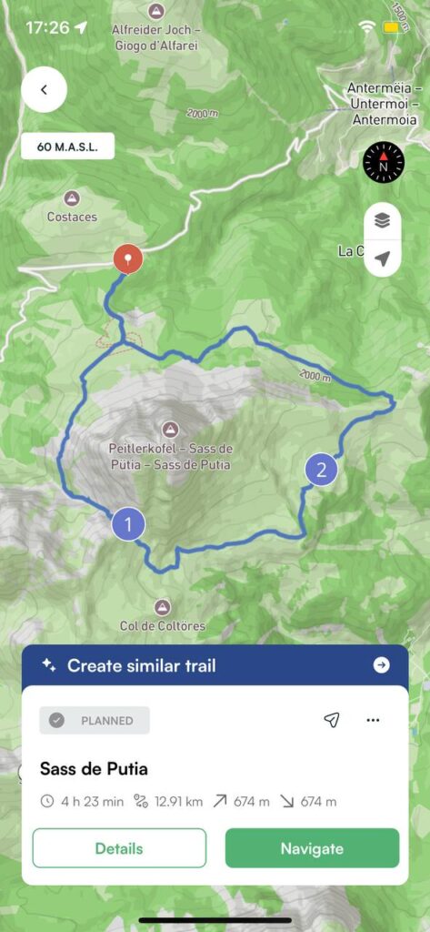
Trail details
| 📍 Departure | Ütia de Börz – Passo delle Erbe (2,006 m) |
| ⛰️ Point on the way | Forcella di Putia (2,360 m), Malga Munt de Fornella (2,080 m) |
| ⏱️ Est time | 4:30 hours |
| 📏 Length | 13 km |
| 〽️ Elevation gain | 675 m |
| 👣 Difficulty | Medium |
Sass de Putia loop trail in South Tyrol: hike description
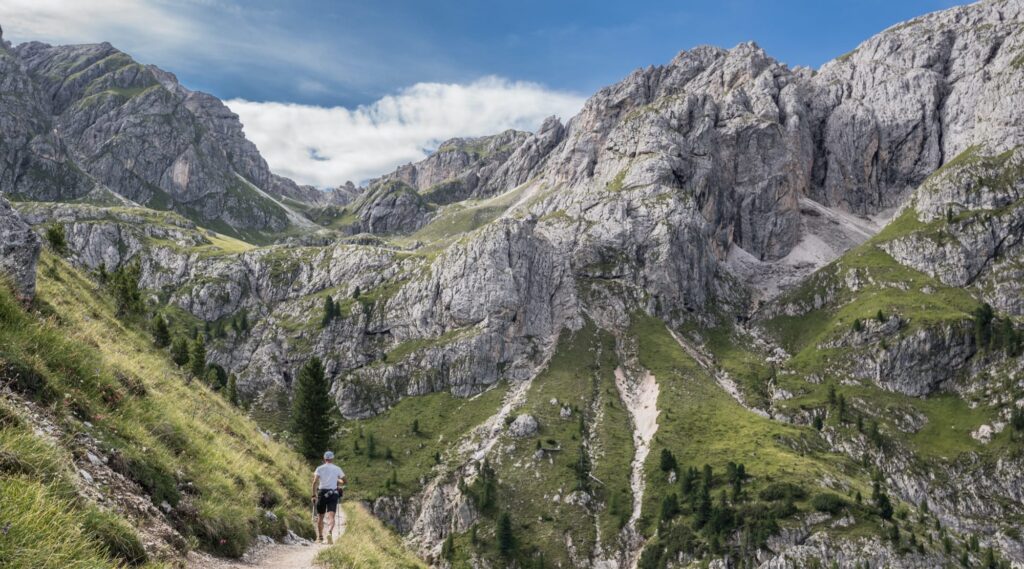
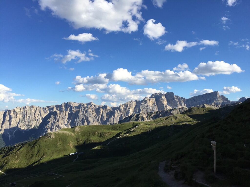
We start from Rifugio Ütia de Börz at 2,006 m and follow the dirt road (trail marker 8A) that crosses the alpine pastures. The atmosphere is peaceful, with green meadows and already stunning views.
From here, the path becomes narrower and more demanding: this is the scree section at the foot of Sass de Putia, definitely the most strenuous part of the hike. After about two hours, we reach the Forcella di Putia (2,361 m), where many hikers stop for a break and to enjoy the panorama.
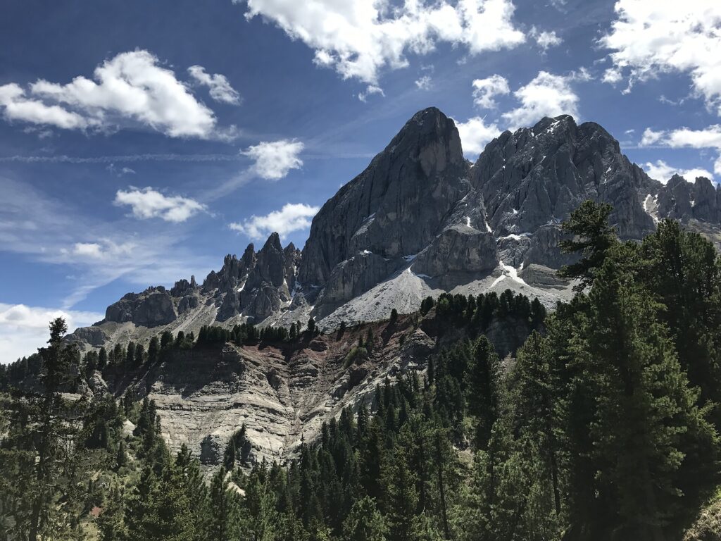
From the saddle, you can choose to climb to the summit of Sass de Putia. Caution: this route is recommended only for experienced hikers, as it involves steep switchbacks and a short section with fixed cables. Another alternative is to head to Rifugio Genova. Or, as we did, you can continue the loop around the massif.
From the pass, the trail descends through alpine meadows. This is a relaxing and scenic part of the hike, with views of the Pale di San Martino and other peaks on the horizon. Along the way, you pass Malga Ütia Vaciara, perfect for a snack, and Rifugio Göma, where we stopped for a longer break. The trail then leads down towards Malga Munt de Fornella.
From here, the loop closes, and in just a few minutes we return to Rifugio Ütia de Börz, the starting point of our hike.
Now that you know the loop trail around Sass de Putia, in South Tyrol all that’s left is to pack your backpack and set off on this adventure.
Always remember to plan your route in advance, check the weather conditions, and bring the right equipment. And if you want to keep all the trails at your fingertips, download Mountain Maps — so you can enjoy your hike with peace of mind, even offline.
Credits: sudtirol.it, boerz.it