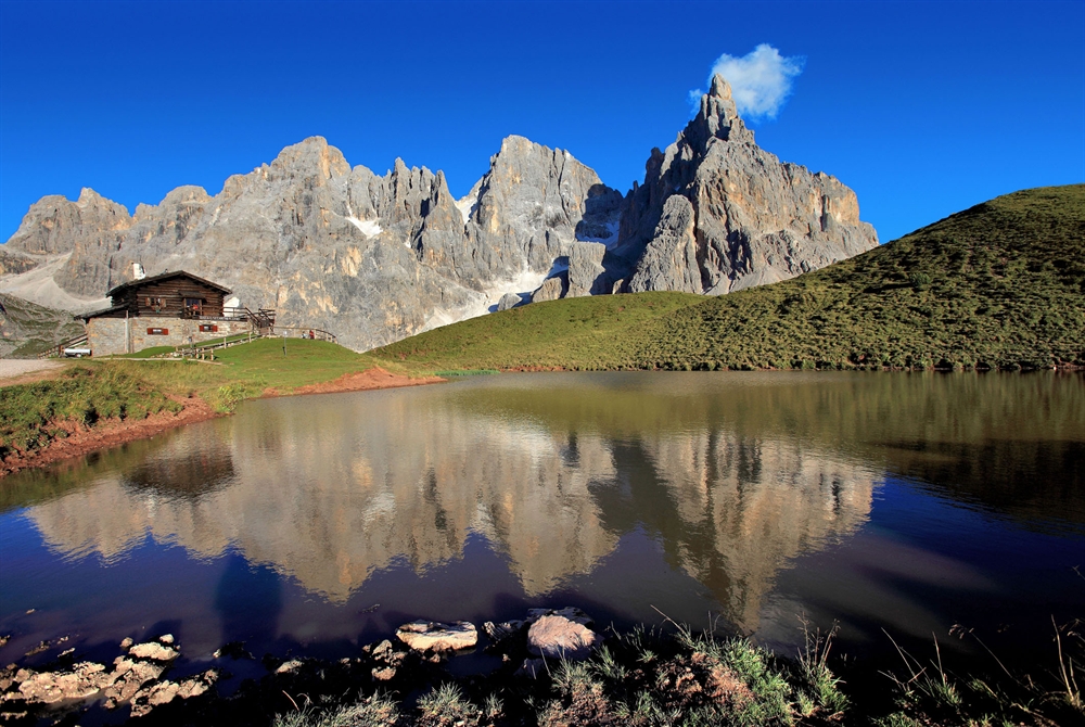
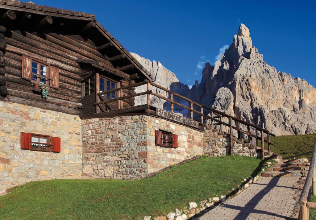
The hike to Baita Segantini is one of the most beloved destinations for those dreaming of a scenic walk in the heart of Trentino’s Dolomites. Perched at 2,200 meters, this historic mountain hut offers one of the most breathtaking views of the Pale di San Martino: right before your eyes rises the famous Cimon della Pala, often called the “Matterhorn of the Dolomites.”
To plan your hike to Baita Segantini in the best way possible, here are some tips and practical information to help you enjoy an unforgettable experience in Val Venegia, Trentino.
Trail details
| 📍 Departure | Pian dei Casoni, Paneveggio (1,680 m) |
| ⛰️ Arrival | Baita Segantini (2,200 m) |
| ⏱️ Est time | 4:15 h |
| 📏 Length | 14 km |
| 〽️ Elevation gain | 520 m |
| 👣 Difficulty | Medium |
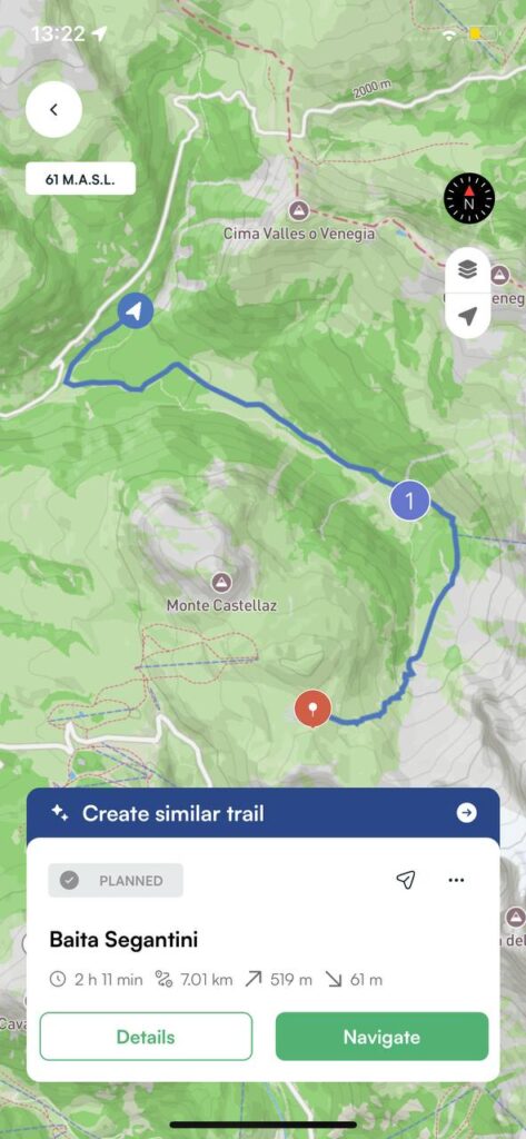
Hike to Baita Segantini: how to get there
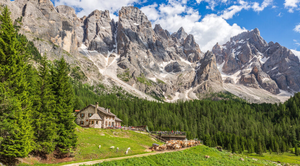
We set off from the parking area at Pian dei Casoni. The forest road immediately enters the woods, offering shade and cool air on summer days, and magical snowy scenery in winter. After about half an hour of walking, we reach Malga Venegia, a perfect spot to pause and enjoy the view of the surrounding peaks.
Continuing on, the trail opens into a lush valley that gently leads us to Malga Venegiota. From here, the view of the Pale di San Martino becomes even more dramatic, with the sheer rock faces seeming almost within reach.
Along the next stretch, we admire Monte Mulaz rising to our left, while the path ahead begins to climb steadily with wide switchbacks. This is the most demanding part of the hike, but never too difficult: with a steady pace, we gain altitude until reaching the pass.
And then, at last, Baita Segantini comes into view. On arrival, the hut is beautifully mirrored in a small alpine lake, creating a play of reflections with the Pale di San Martino as a stunning backdrop.
The hike to Baita Segantini in Trentino’s Dolomites is one of the most rewarding experiences you can enjoy in Trentino, no matter the season.
Always remember to plan your route in advance, check the weather conditions, and bring the right equipment. And if you want to keep all the trails at your fingertips, download Mountain Maps — so you can enjoy your hike with peace of mind, even offline.
Credits: baitasegantini.it, fiemme.it, latrentina.it